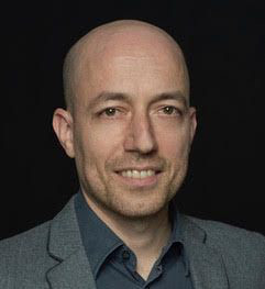
Senior project scientist
The main experience of Othmar Frey is in research, development, and implementation of innovative 2-D and 3-D (tomographic) synthetic aperture radar (SAR) imaging techniques and interferometric techniques for applications such as 3-D forest mapping, ground deformation monitoring (persistent scatterer interferometry / differential tomography), and profiling the structure of snowpacks, using various radar sensors and platforms (spaceborne, airborne, and ground-based SAR sensors). At Gamma Remote Sensing, Othmar Frey has been active in various national and international research projects, as a PI as well as a co-investigator, and in consulting related to SAR imaging, interferometric and tomographic applications. He is also active in the development of the Gamma Software. In addition to his position with Gamma Remote Sensing he is also a Senior Research Scientist and Lecturer at ETH Zurich, at the Chair of Earth Observation and Remote Sensing.
Publications
https://scholar.google.ch/citations?user=g5IFsYwAAAAJ&hl=de
Professional Education
2002: M.Sc. in Geomatic Engineering from the Swiss Federal Institute of Technology - ETH Zurich, Switzerland.
2010: Ph.D. in Science from the University of Zurich, Switzerland, for a thesis on "Synthetic Aperture Radar Imaging in the Time Domain for Nonlinear Sensor Trajectories and SAR Tomography".
Employment Record
2011-date: Research Scientist at GAMMA Remote Sensing Research and Consulting Ltd. Main tasks include software development, research and consulting activities related to SAR processing, as well as interferometric data processing.
2011-date: Senior Research Fellow & Lecturer at the Chair of Earth Observation and Remote Sensing, Institute of Environmental Engineering, ETH Zurich, Switzerland. Main research activities are in SAR focusing algorithms, SAR tomography, SAR interferometry techniques and applications (further information is found here).
2004-2010: Research Associate & PhD Position at the Remote Sensing Laboratories, University of Zurich. Research and development in the field of SAR signal processing. Implementation of a signal-processing software for data processing of advanced imaging modes, such as airborne SAR tomography and SAR data acquisitions from nonlinear flight tracks. Design of airborne SAR experiments.
2002-2004: Research Associate at the Remote Sensing Laboratories, University of Zurich. Pre-phase studies related to the spaceborne SAR system TerraSAR-X on behalf of the German Aerospace Center (DLR) including a geometric error budget analysis for TerraSAR-X data products and a study on atmospheric effects in synthetic aperture radar data.
2002: Research Associate at the Soil Physics Group, Institute of Terrestrial Ecology, Swiss Federal Institute of Technology - ETH Zurich. Geostatistical analysis and filtering of X-ray computed tomography scans of soil samples.
Teaching
2011-date: Lecturer at ETH Zurich, Switzerland. "Applied Radar Remote Sensing for Environmental Parameter Estimation".
2007-2010: Associate Lecturer at University of Zurich, Switzerland, teaching at bachelor and master level. "Remote Sensing III: Geometry, Radiometry, Classification", "SAR and LiDAR", "Matlab programming".
Languages
Mother tongue: German. Proficient in English. Good level in French and Spanish.
Professional Affiliations
Member of Institute of Electrical and Electronics Engineers (IEEE) Geoscience and Remote Sensing Society
Aerospace and Electronic Systems Society